

April 22, 2022
Rendered.ai Teams with Rochester Institute of Technology to Power Synthetic Data
BELLEVUE, Wash. and ROCHESTER, N.Y., April 22, 2022 — Rendered.ai, a leading platform for physics-based synthetic data, and the Rochester Institute of Technology’s Digital Imaging and Remote Sensing (DIRS) Laboratory today announced a collaboration to combine the physics-driven accuracy of the DIRSIG synthetic imagery model with Rendered.ai’s cloud-based platform for high volume synthetic data generation.
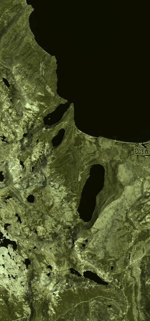
Example of simulated single band satellite image output created in DIRSIG that will be available through Rendered.ai. Credit: RIT DIRS Laboratory
Machine Learning (ML) algorithms using Computer Vision (CV) data provide a key tool for exploiting the rapidly expanding capability and content of Earth Observations (EO) collection and analytics companies around the world. Rendered.ai provides a platform as a service (PaaS) for data scientists and CV engineers to scalably produce large, configurable synthetic CV datasets in the cloud for training Artificial Intelligence (AI) and ML systems.
The DIRSIG model produces a range of simulated output representing passive single-band, multi-spectral, or hyper-spectral imagery from the visible through the thermal infrared region of the electromagnetic spectrum. DIRSIG is widely used to test algorithms and to train analysts on simulated standard imagery products. The Rendered.ai team has built simulators for visible light and synthetic aperture radar (SAR), however DIRSIG’s breadth of capability and ongoing investment by granting agencies will provide qualified Rendered.ai customers a much wider range of field-tested and production-quality sensor modeling technology.
“DIRSIG has been providing synthetic imagery to expert customers for decades,” said Scott Brown, Ph.D., principal scientist and project lead. “Our collaboration with Rendered.ai enables us to bring our proven capability to a wider audience at a time when satellite and other forms of remote sensing data collection are rapidly expanding.”
The initial project with DIRSIG and Rendered.ai is being developed for a confidential lighthouse customer with the goal to make the basic integration available for organizations through a synthetic data channel, a purpose-built synthetic data application, within the Rendered.ai framework.
“Expansion of the Earth Observation market is not only increasing the diversity of data types and frequency of data collection available to government and commercial users, but it is also driving the need to find new and faster automated techniques for extracting knowledge from massive streams of imagery,” said Nathan Kundtz, Ph.D., CEO of Rendered.ai. “We built our platform to put rapid generation of synthetic data at customers’ fingertips for innovation and experimentation. We’re happy that the DIRSIG team has partnered with us to bring to our users the best simulated content possible.”
Rendered.ai and RIT will announce details and requirements for accessing DIRSIG on the platform at a future date.
Both the Rendered.ai and DIRSIG teams will be represented at the United States Geospatial Intelligence Foundation’s (USGIF) 2022 GEOINT Symposium in Aurora, Colorado, from April 24-27 and would be happy to share more information about the collaboration.
About Rendered.ai
Rendered.ai is a Platform as a Service for synthetic data generation that puts physically accurate sensor modeling and a closed-loop data engineering workflow in the hands of data scientists and innovators. Founded by physicist Nathan Kundtz, Rendered.ai has created and powers the first-ever developer framework for synthetic data, turning simulation tools into synthetic data capabilities which includes scenario generation, 3D model libraries, asset management, compute management, annotation, metadata management and more. Rendered.ai is a privately held company based in Bellevue, Washington. For more information on the company and to sign up for a free account, please visit: www.rendered.ai. You can also visit Rendered.ai at GEOINT 2022 in booth #835.
About DIRS Laboratory at RIT
The Digital Imaging and Remote Sensing (DIRS) Laboratory focuses on the development of tools to extract information about the Earth from aerial and satellite imaging systems with an emphasis on the application of science and engineering to solving end-to-end remote sensing problems using a systems engineering approach. The DIRS Laboratory, formed more than 30 years ago, is housed within the Chester F. Carlson Center for Imaging Science, an academic unit within RIT’s College of Science, and has about 40 graduate students conducting research who are supported by six faculty and 17 full-time research and administrative staff. DIRS also has on-going research partnerships with multiple federal agencies, large and small companies, and other academic institutions. Visit us on the web at https://www.rit.edu/dirs.
Source: Rendered.ai
Leading Solution Providers


Tabor Network
Sponsored Multimedia


Featured Events
-
Call & Contact Center Expo
 April 24 - April 25Las Vegas NV United States
 -
AI & Big Data Expo North America 2024
 June 5 - June 6Santa Clara CA United States
 -
AI Hardware & Edge AI Summit 2024
 September 10 - September 12San Jose CA United States
 -
CDAO Government 2024
 September 18 - September 19Washington DC United States