

Tag: mapping

500+ Organizations Team on ‘Placekey’ Standard for Identifying Physical Places
Over 500 organizations are backing a new industry standard for identifying physical places. The new standard uses a combination of up to 15 characters to specify where a place is, along with optional additional informati Read more…

All-Weather Image Data Put to the Test
Mapping data collected by multi-spectral satellites is being combined with AI and computer vision algorithms to help extract ground features and building footprints. The potential applications for those data products ran Read more…
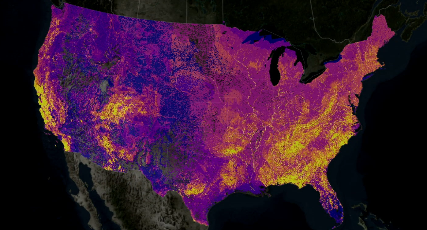
Big Data and AI Converge in Map to Protect Biodiversity
What's living where? Those are the basic pieces of data that biologists and conservationists are hoping to collect and load into the Map of Biodiversity Importance, a dynamic new map unveiled this week at the Esri User C Read more…

Drone Data Ecosystem Growing Fast, Report Says
The ecosystem that's emerged around the collection and analysis of data from drones is growing very quickly, according to a new report issued by DroneDeploy, one of the companies operating in the space. According to D Read more…

Microsoft Transfers U.S. Map Data to GitHub
Microsoft, which reaffirmed its commitment to open source software development with its blockbuster acquisition of the GitHub project collaboration platform earlier this month, is releasing a huge trove of street mapping Read more…

Drone Data Accelerates Mapping
Add to the mounting list of data types: aerial data captured by drones, much of it used for map making and field surveys. A recent report on trends in the booming drone industry finds that commercial drones equipped w Read more…
Leading Solution Providers


Tabor Network
Sponsored Multimedia


Featured Events
-
Call & Contact Center Expo
 April 24 - April 25Las Vegas NV United States
 -
AI & Big Data Expo North America 2024
 June 5 - June 6Santa Clara CA United States
 -
AI Hardware & Edge AI Summit 2024
 September 10 - September 12San Jose CA United States
 -
CDAO Government 2024
 September 18 - September 19Washington DC United States