Drone Data Accelerates Mapping

(Maria Dryfhout/Shutterstock)
Add to the mounting list of data types: aerial data captured by drones, much of it used for map making and field surveys.
A recent report on trends in the booming drone industry finds that commercial drones equipped with mapping software have thus far captured data on an estimated 10 million acres of land in 160 countries. DroneDeploy, a cloud software vendor, claimed the data haul translates into $150 million in economic value for the commercial drone industry.
(That rosy forecast is based on the following calculations: 20 minutes for a commercial drone to cover 100 acres + three hours to complete a map = three to four hours to map 100 acres; that total is then multiplied by 10 million acres mapped so far, and multiplied once again by average hourly rate charged by drone operators offering mapping services.)
Compared to standard aerial mapping that produces photos and video, platform vendors like DroneDeploy claim they can use commercial drones to map about 100 acres from 400 feet in about 20 minutes, producing a detailed map within fours hours. One user cited by the vendor said the mapping software allowed it to process maps and combine data into a single program. That allowed the user to, for example, measure distances without have to scale maps manually.
The industry study also found that 60 percent of commercial drone users are mappers, leveraging software platforms to gather, format and share data captured by drones. One result, the study found, was many maps are now being updated on a weekly basis.
The earliest adopters of drone data after drone service providers are agriculture, surveying and construction, in that order, the vendor study found. DroneDeploy offers an agricultural app that uses drone data to automate plant counting and crop quality. The app produces 2-D orthomosaic maps—a grouping of many overlapping images of a defined area that are combined into a single, detailed mosaic—along with 3-D models of farmers’ fields.
As federal regulations slowly emerge, the growing drone industry is adding to the already soaring amounts of geospatial and other data available to industries ranging from agriculture to oil and gas exploration. DroneDeploy estimates there are now 29,000 certified drone pilots, with drone mapping specializations resulting in a 16-percent increase in average pay for operators compared to those offering general drone services.
These and other data-gathering skills are a key component of the industry estimate of the growing economic value generated by drone users.
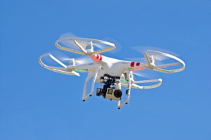
Multi-rotor drones (like the model shown above) are by far the most popular models for mapping (97 percent), owing to their maneuverability.
According to the Flightline Geographics subsidiary of Waypoint Mapping, drones can capture images with resolutions down to one inch, and deliver that data within hours, compared to the days typically required by manned aircraft.
Recent items:
5 Ways Geospatial Data is Driving Analytics in the Real World
Exploring New Areas For Geospatial Data


