

December 3, 2015
Big Data Heads to Orbit with Weather Sats
Proponents assert the sky is the limit for big data. Indeed, data analytics is now headed into orbit with a deal between an Indian space agency and a commercial satellite provider specializing in microsatellites carrying sensors to collect earth and space weather along with climate data.
Satellite sensor developer PlanetiQ, Boulder, Colo., said Thursday (Dec. 3) weather and climate data would be folded into weather models to improve storm predictions.
The deal with Antrix Corp. Ltd., the commercial arm of the Indian Space Research Organization, calls for launching the first two polar-orbiting satellites during the fourth quarter of 2016. The full 12-satellite constellation would be launched by 2017. The partners said the network would help improve global weather forecasting and climate monitoring. It would also boost capabilities in the emerging field of space weather prediction.
The satellites would be launched aboard Polar Satellite Launch Vehicle operated by the Indian space agency. Most weather satellites fly north-south orbits over the poles to provide 24-hour coverage of the entire planet.
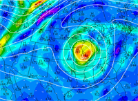
Each 10-kilogram microsatellite will carry PlanetiQ’s Pyxis-RO weather sensor designed to penetrate through clouds and storms to the Earth’s surface. The resulting “vertical” weather data will be used to upgrade current weather models at a time when storms are growing more intense. For example, Hurricane Patricia, which struck the west coast of Mexico in October with little warning, was the most intense tropical cyclone ever recorded in the Western Hemisphere.
“The world today lacks sufficient data to feed into weather models, especially the detailed vertical data that is critical to storm prediction,” PlanetiQ CEO Chris McCormick noted in a statement announcing the contract. “Capturing the detailed vertical structure of the atmosphere from pole to pole, especially over the currently under-sampled oceans, is the missing link to improving forecasts of high-impact weather.”
The company claims its weather sensor technology quadruples the data collection capabilities of a technique called radio occultation that tracks the bending of GPS and other signals as they travel through the atmosphere. The sensor then converts the bending angle into precision measurements of global temperature, pressure and water vapor in the atmosphere.
For space weather applications, it measures electron density in the Earth’s ionosphere as it reacts to solar flares that can disrupt satellite communications and ground-based electronics.
Along with GPS, the sensor tracks navigation signals from the European Galileo, Chinese Beidou and Russian GLONASS satellite navigation constellations.
PlanetiQ said the 12-satellite weather constellation would collect about 34,000 “occultations” per day, resulting in a roughly equivalent sampling of land and water. Each high-resolution vertical profile of atmospheric data includes measurements extending from about 200 meters (about 656 feet) to the ionosphere, which extends from about 50 to 600 miles above the Earth.
Weather balloons have traditionally been used to collect vertical weather data. PlanetiQ and the Indian space agency are essentially taking a big data approach to weather data collection by dramatically boosting the scale and frequency of sensor measurements. “Capturing the detailed vertical structure of the atmosphere from pole to pole, especially over the currently under-sampled oceans, is the missing link to improving forecasts,” McCormick asserted.
The technique could also address concerns that current weather models, especially the much-maligned U.S. Global Forecast System, lack sufficient resolution to accurately predict the path of major storms.
Along with weather forecasting, the company said its satellite data services could be used for aviation, shipping, offshore energy exploration, military and intelligence as well as agriculture.
Recent items:
Data Platform Tracks Deforestation, Carbon Emissions
Climate Researchers Crunch Data on Weather Extremes
Technologies:
Systems
Leading Solution Providers


Tabor Network
Sponsored Multimedia


Featured Events
-
Call & Contact Center Expo
 April 24 - April 25Las Vegas NV United States
 -
AI & Big Data Expo North America 2024
 June 5 - June 6Santa Clara CA United States
 -
AI Hardware & Edge AI Summit 2024
 September 10 - September 12San Jose CA United States
 -
CDAO Government 2024
 September 18 - September 19Washington DC United States